Description
***OLD MAP OF WARWICKSHIRE BY JOHN SPEED***
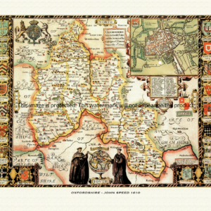
A reproduction of a historic map of Warwickshire by John Speed first published in 1610, featuring Warwick, Stratford-upon-Avon and Coventry. This reproduction map is printed on archival paper using giclee printing techniques and should not fade for 75 years. It is supplied unframed, in a range of sizes.
John Speed (1552-1629) is arguably the most famous English cartographer of any period, as a result of his atlas The Theatre of the Empire of Great Britaine. The individual maps are the best known and among the most sought-after of all county maps. The maps themselves were derived from the best and most up-to-date sources available. However, Speed also made innovations of his own – introducing town plans on many of the maps, including county boundaries on almost all maps and also the coats of arms of local Earls and Dukes as well the Royal Arms. The original maps were printed in monochrome, however proud owners often had their maps hand-coloured. The overall effect is to produce very decorative, attractive and informative maps.
Our images are scans of original hand-coloured maps and include the marks and blemishes associated with the passing of the years. They are printed on 310 gsm archival quality professional art paper by a state-of-the-art giclee printer using pigment inks. A Certificate of Authenticity is supplied.
Warwickshire Map - Further information
John Speed's map of Warwickshire appeared in his Theatre of the Empire of Great Britaine, first published in 1611-12, with the individual plate engraved in Amsterdam by Jodocus Hondius. That publishing history is common to every sheet in the atlas, but the plate itself is titled, in Speed's own wording, "The Counti of Warwick the Shire Towne and Citie of Coventre Described" — a title that already announces two features unique to this particular county map.
By the early seventeenth century Warwickshire's older pattern of ten Domesday-period hundreds had long since been consolidated into four, and it is these four divisions — Barlichway, Hemlingford, Kineton (also called Kington) and Knightlow — that the map lays out across the shire in Speed's usual colour wash, the device he used on every county sheet to show how local government and justice were parcelled out on the ground. The county is further divided by geography as much as administration: the wooded Forest of Arden fills the north-western half of the sheet, while the open, sheep-grazed Feldon country lies to the south-east across the River Avon.
Unusually for Speed, this one plate carries two town insets rather than the more usual single plan. Warwick is shown with its castle, its Chipping Market and the circuit of its town walls, at a scale close to 1:10,500 and thought to derive from a survey Speed himself carried out in the county around 1607; Coventry, named alongside Warwick in the map's own title, appears as the shire's principal market town, a reflection of its long-standing status as a city and county in its own right, separate from the shrievalty of Warwickshire proper.
The sheet is finished in the strapwork and fretwork cartouches, costumed figures and decorative scale bars typical of the atlas, and the coats of arms ranged around its border belong to the Earls of Warwick, the county's leading noble family since soon after the Conquest — Speed's usual way of tying a shire's map to the aristocratic house most associated with it.
Warwickshire's best-known legend, that of the giant-slaying knight Guy of Warwick, was closely bound up with the county and its earls in the chronicles and antiquarian writing of Speed's own time, and readers of the period would have known the tale well. Surviving descriptions of the engraved plate, however, do not confirm a pictorial scene of Guy anywhere on the map itself, so it is safest to treat the legend as part of the county's wider literary reputation in this period rather than as a confirmed image on this particular sheet.
Later seventeenth-century editions of the atlas, issued under publishers including John Sudbury and George Humble, reused the Warwickshire plate largely unaltered, so hand-coloured impressions produced across the century still carry the same twin town plans and armorial border that made the sheet distinctive from the moment it was first engraved.