Description
***OLD MAP OF LANCASHIRE BY JOHN SPEED***
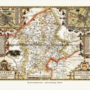
A reproduction of a historic map of Lancashire by John Speed first published in 1610, covering Lancaster, Preston and the historic county’s stretch down to Liverpool and Manchester. This reproduction map is printed on archival paper using giclee printing techniques and should not fade for 75 years. It is supplied unframed, in a range of sizes.
John Speed (1552-1629) is arguably the most famous English cartographer of any period, as a result of his atlas The Theatre of the Empire of Great Britaine. The individual maps are the best known and among the most sought-after of all county maps. The maps themselves were derived from the best and most up-to-date sources available. However, Speed also made innovations of his own – introducing town plans on many of the maps, including county boundaries on almost all maps and also the coats of arms of local Earls and Dukes as well the Royal Arms. The original maps were printed in monochrome, however proud owners often had their maps hand-coloured. The overall effect is to produce very decorative, attractive and informative maps.
Our images are scans of original hand-coloured maps and include the marks and blemishes associated with the passing of the years. They are printed on 310 gsm archival quality professional art paper by a state-of-the-art giclee printer using pigment inks. A Certificate of Authenticity is supplied.
Lancashire Map - Further information
John Speed's map of Lancashire appeared in his Theatre of the Empire of Great Britaine, first published in 1611-12, with the individual plate engraved in Amsterdam by Jodocus Hondius and dated 1610 on the sheet itself. That publishing history is common to all of Speed's county maps, but the Lancashire plate is unusually crowded with dynastic history, reflecting the county's outsized role in the story of the English crown.
Titled "The Countie Pallatine of Lancaster Described and Divided into Hundreds," the map sets out Lancashire's six historic hundreds — West Derby, Leyland, Amounderness, Blackburn, Salford and Lonsdale — along with the separate Liberties of Furness in the far north of the county, so that a reader could see at a glance how the shire's government and courts were parcelled out on the ground.
Around the map's margins Speed and Hondius set eight portrait roundels, rather than the coats of arms of a line of resident earls that decorate most other county sheets. These show the Lancastrian kings Henry IV, Henry V, Henry VI and Henry VII, together with the Yorkist Edward IV, Edward V and Richard III, and Elizabeth of York — grouped, according to dealer descriptions of the plate, under the legend "Blessed are the Peace-Makers." The pairing of Henry VII and Elizabeth of York points to the point of the whole arrangement: their marriage in 1486 united the warring houses of Lancaster and York and produced the Tudor dynasty, so Speed used the margins of the Lancashire sheet to compress the entire Wars of the Roses into a single genealogical portrait gallery.
Among the shields worked into the plate are the arms of John of Gaunt, 1st Duke of Lancaster, and of his ancestor Edmund Crouchback, 1st Earl of Lancaster and a son of Henry III — tracing the line of the House of Lancaster back to its thirteenth-century origin and explaining why the county, held as a royal Duchy since Gaunt's day, is styled a "Countie Pallatine" in the map's own title.
Set into the map's upper corner is an inset plan of Lancaster itself, showing the town's castle, churches and gates in detail; dealers note that Speed based this plan on his own survey of the town, said to have been carried out in August 1607. A mermaid holding a mirror decorates the sea off the Lancashire coast, a piece of purely ornamental engraving typical of the atlas as a whole.
Later 17th-century editions of the atlas reused this plate largely unaltered, so surviving hand-coloured impressions still carry the same royal portrait gallery, ducal arms and town plan that made the Lancashire sheet one of the most densely historical in Speed's entire county series.