Description
***OLD MAP OF MONMOUTHSHIRE BY JOHN SPEED***
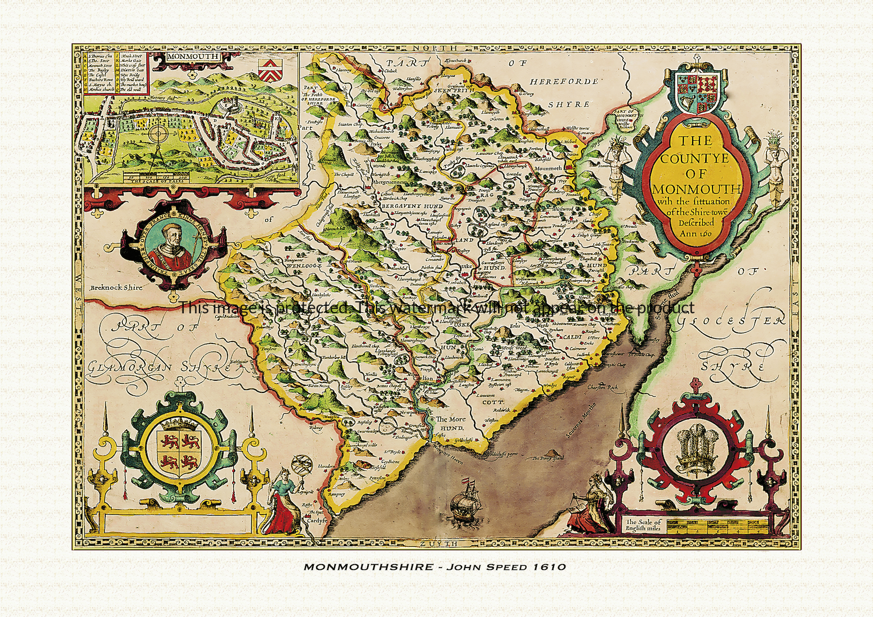
A reproduction of a historic map of Monmouthshire by John Speed first published in 1610, featuring Monmouth, Chepstow, Abergavenny and the Wye Valley. This reproduction map is printed on archival paper using giclee printing techniques and should not fade for 75 years. It is supplied unframed, in a range of sizes.
John Speed (1552-1629) is arguably the most famous English cartographer of any period, as a result of his atlas The Theatre of the Empire of Great Britaine. The individual maps are the best known and among the most sought-after of all county maps. The maps themselves were derived from the best and most up-to-date sources available. However, Speed also made innovations of his own – introducing town plans on many of the maps, including county boundaries on almost all maps and also the coats of arms of local Earls and Dukes as well the Royal Arms. The original maps were printed in monochrome, however proud owners often had their maps hand-coloured. The overall effect is to produce very decorative, attractive and informative maps.
Our images are scans of original hand-coloured maps and include the marks and blemishes associated with the passing of the years. They are printed on 310 gsm archival quality professional art paper by a state-of-the-art giclee printer using pigment inks. A Certificate of Authenticity is supplied.
Monmouthshire Map - Further information
John Speed's map of Monmouthshire appeared in his Theatre of the Empire of Great Britaine, first published in 1611-12, with the individual plate engraved in Amsterdam by Jodocus Hondius and generally dated 1610 on the sheet itself. That publishing history is common to all of Speed's county maps, but the Monmouthshire plate carries a set of features and a story that belong to it alone.
Monmouthshire was, in cartographic terms, a comparatively new county when Speed drew it: created out of the old Marcher lordships by the Laws in Wales Act of 1535 and formally divided into six hundreds — Abergavenny, Caldicot, Raglan, Skenfrith, Usk and Wentloog — by 1542, less than seventy years before this plate was engraved. Speed's map shows that division clearly, with the shire's rivers, the Wye, the Usk and the Monnow, marking its boundaries with Herefordshire and Gloucestershire as they drain toward the Severn estuary.
Set into the map is an inset plan of Monmouth itself, one of the earliest printed plans of the town and part of a set of roughly fifty English and Welsh town plans that Speed's atlas put into print for the first time anywhere. Beside it Speed placed a medallion portrait of Henry V, styled in older sources "Henry the Great," to mark the town's proudest association: Henry was born in the tower above the gatehouse of Monmouth Castle on 16 September 1386, and was known throughout his life as Henry of Monmouth. The future victor of Agincourt in 1415 was, in effect, the county town's most famous son, and Speed built that connection directly into the map rather than leaving it to the accompanying text.
As on most of Speed's county sheets, the plate is further decorated with coats of arms and strapwork ornament around its borders and title cartouche, in keeping with the engraving style Hondius brought to the whole atlas.
Later seventeenth-century editions of the atlas, issued under publishers including George Humble and, from 1676, Thomas Bassett and Richard Chiswell, reused this plate largely unaltered, so surviving hand-coloured impressions still carry the same Monmouth inset and Henry V medallion that made the sheet distinctive from the moment it was first engraved.