Description
***OLD MAP OF RADNORSHIRE BY JOHN SPEED***
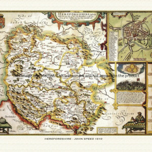
A reproduction of a historic map of Radnorshire by John Speed first published in 1610, featuring Presteigne, Rhayader and Knighton in the Welsh Marches. This reproduction map is printed on archival paper using giclee printing techniques and should not fade for 75 years. It is supplied unframed, in a range of sizes.
John Speed (1552-1629) is arguably the most famous English cartographer of any period, as a result of his atlas The Theatre of the Empire of Great Britaine. The individual maps are the best known and among the most sought-after of all county maps. The maps themselves were derived from the best and most up-to-date sources available. However, Speed also made innovations of his own – introducing town plans on many of the maps, including county boundaries on almost all maps and also the coats of arms of local Earls and Dukes as well the Royal Arms. The original maps were printed in monochrome, however proud owners often had their maps hand-coloured. The overall effect is to produce very decorative, attractive and informative maps.
Our images are scans of original hand-coloured maps and include the marks and blemishes associated with the passing of the years. They are printed on 310 gsm archival quality professional art paper by a state-of-the-art giclee printer using pigment inks. A Certificate of Authenticity is supplied.
Radnorshire Map - Further information
John Speed's map of Radnorshire appeared in his Theatre of the Empire of Great Britaine, first published in 1611-12, with the individual plate engraved in Amsterdam by Jodocus Hondius and dated 1610 on the sheet itself, published in London by John Sudbury and George Humble. That publishing history is common to all of Speed's county maps, but the Radnorshire plate is shaped by a fact that sets it apart from almost every other sheet in the atlas: this was a county with no earl.
The map's full title reads "The Countie of Radnor Described and the Shyre Townes Sittuatione," set within one of three strapwork cartouches on the sheet, the others carrying the scale bar and a compass rose. Radnorshire itself is shown divided into its six historic hundreds — Cefnllys, Colwyn, Knighton, Painscastle, Radnor and Rhaiadr — the administrative units created only in 1536, when the Laws in Wales Acts stitched together the Marcher lordships and old Welsh cantrefs of Maelienydd and Elfael, along with the commotes of Gwrtheyrnion and Deuddwr, into a single shire on the English model.
That recent, artificial origin as a shire is reflected in the map's heraldry. Whereas Speed filled the borders of most English county maps with the arms of a line of resident earls, Radnorshire had never been held as an earldom in its own right. Antiquarian dealer descriptions of the plate note that its armorial display instead carries the Royal Arms and the Arms of Wales, together with the Prince of Wales's feathers, in place of any single noble family's shield — though this detail is drawn from trade descriptions rather than an academic catalogue, and should be read as the accepted trade account rather than settled fact. What is well documented is the structural point behind it: Radnorshire, straddling the old boundary between England and Wales, never developed into an earldom at all.
Set into the map is an inset plan of the shire town, New Radnor, one of the roughly fifty English and Welsh town plans Speed's atlas introduced into print for the first time. The verso of the printed sheet, as with other counties in the atlas, carried an English-language description of Radnorshire's geography, market towns and villages, meant to be read alongside the engraving rather than as a separate text.
The surrounding countryside on the map is dominated by Radnor Forest and the upland moors that made the county one of the most thinly populated in England and Wales, with the River Wye marking much of its southern boundary. The county's ambiguous status between the two nations was proverbial enough to produce the local rhyme "Neither Wales nor England, just Radnorsheer" — a line that captures exactly the in-between administrative history the map itself embodies.
Later 17th-century editions of the atlas, issued under publishers including George Humble, reused the plate largely unaltered, so surviving hand-coloured impressions of the Radnorshire sheet still show the same six-hundred division and royal, rather than comital, heraldry that marked it out from its neighbours from the moment it was first engraved.